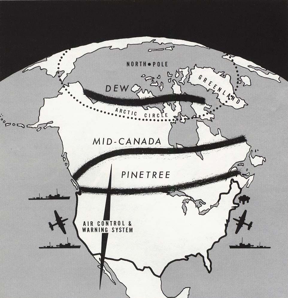
The Pine Tree Line
The goal of this network of radar stations was to provide early warning of any incoming nuclear threats and protect major population centers in both the US and Canada.
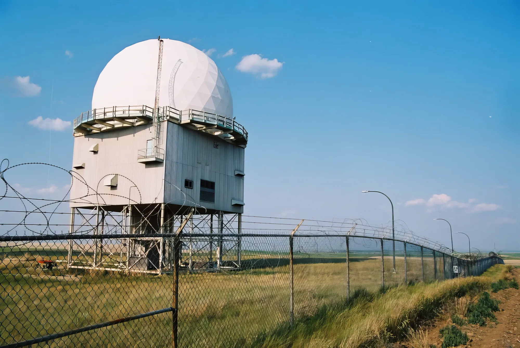
Welcome to the first installment of our series on the history of Cold War technology in North America. In this post, we'll be exploring the creation and early struggles of the Pinetree Line, a radar defense station built in the 1950s to protect the United States and Canada from the threat of nuclear war.
In 1951, following the first Soviet nuclear bomb test, the Permanent Joint Board on Defence presented Recommendation 51/1 to build the Continental Radar Defence Station, also known as the Pinetree Line. The goal of this network of radar stations was to provide early warning of any incoming nuclear threats and protect major population centers in both countries.
The Pinetree Line was a classified military project, and as such, much of the information about it was not publicly available at the time. That said, the locations were often close to population centers and the existence and location of the radar sites would be nearly impossible to hide.
It wasn't until many years later that more technical details about the line and its capabilities were made available to the public through the release of classified documents and the testimony of those involved in its construction and operation.
The Line Before The Line
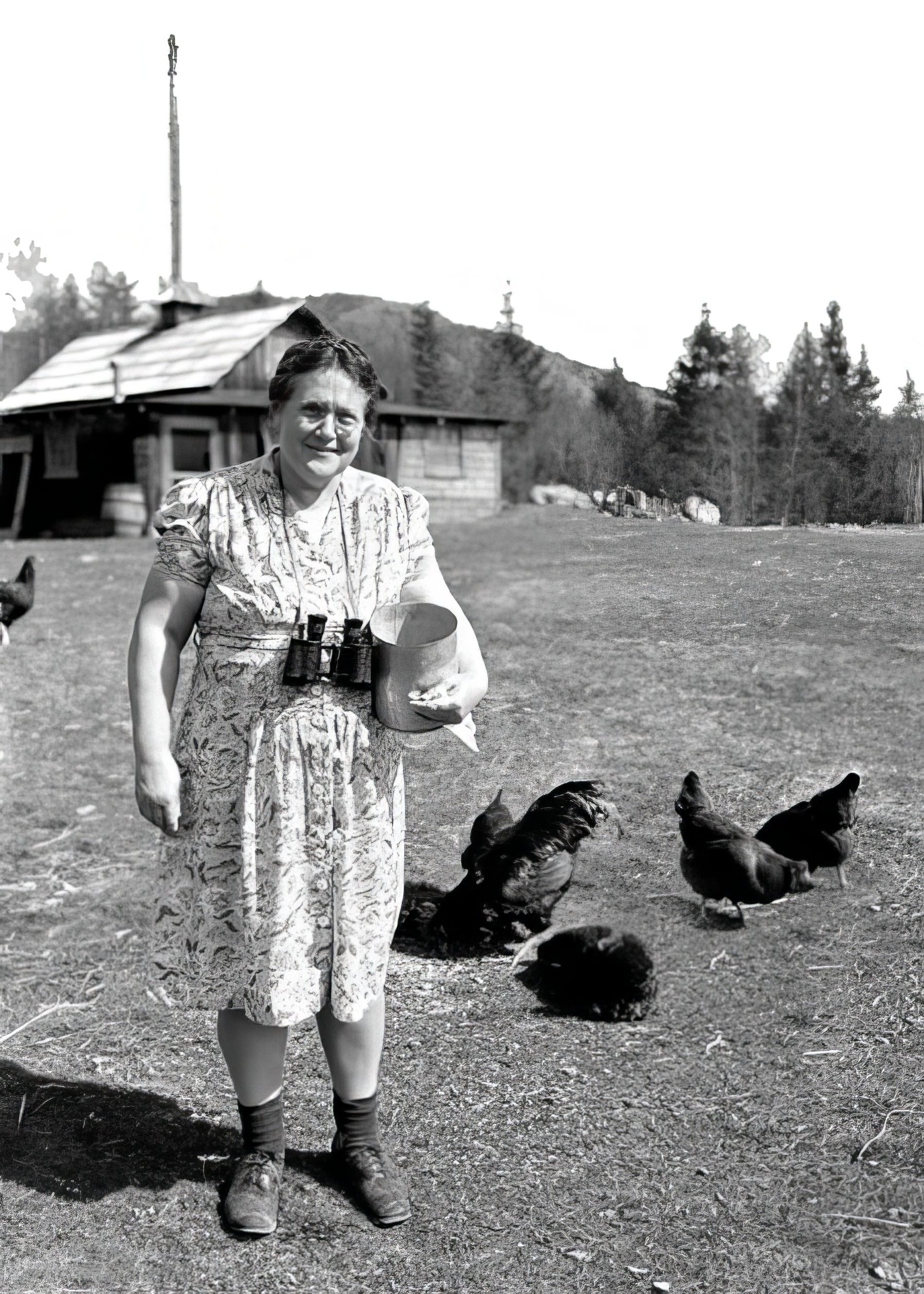
During World War II, there were concerns about aircraft flying over North America's northern coasts, leading to the creation of the Canadian Aircraft Detection Corps in May 1940. This organization trained civilian volunteers in aircraft detection and grew to a peak enrollment of 30,000 members across the country by the end of 1943.
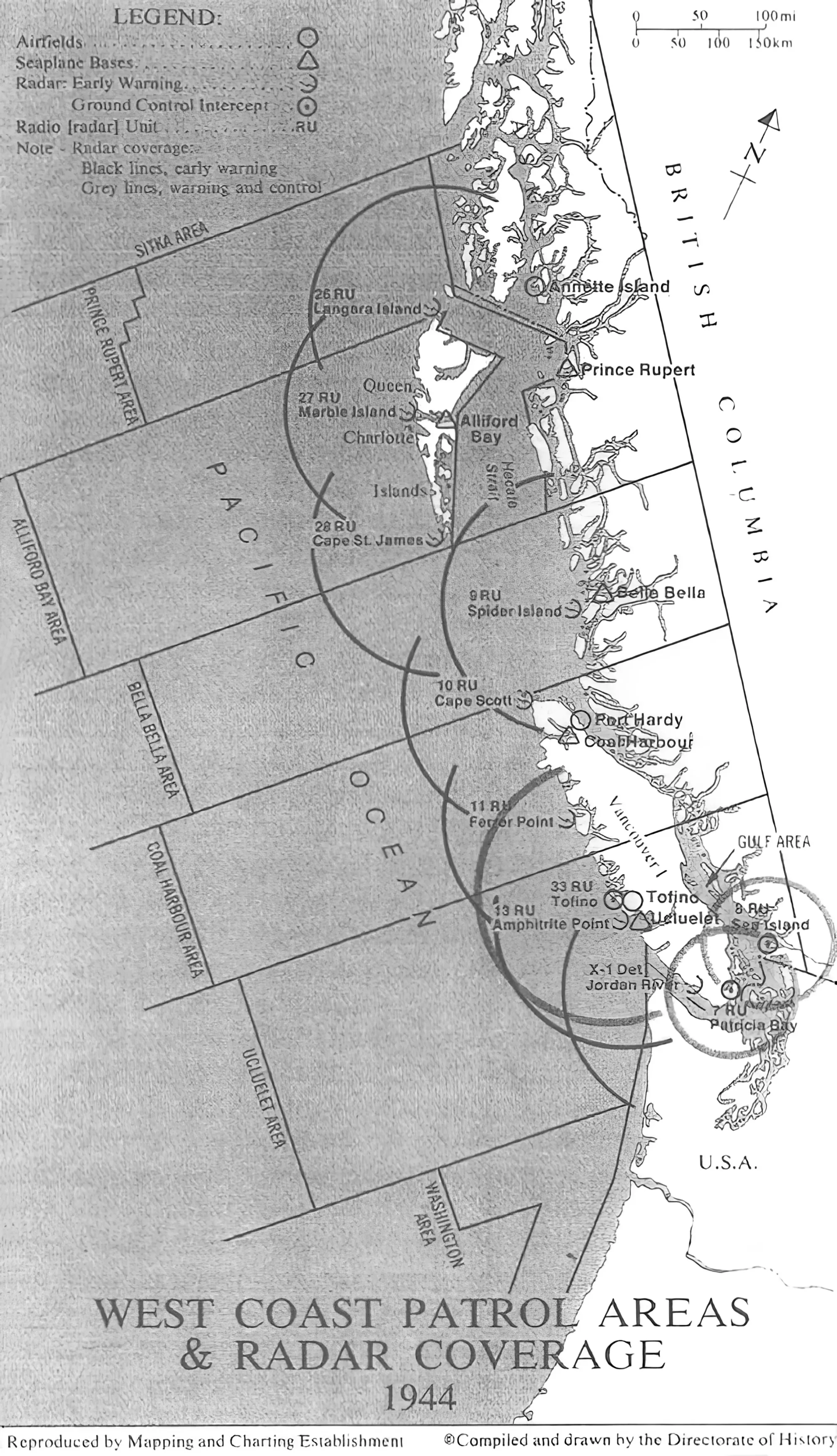
However, the aircraft detection system had its problems, particularly on the west coast of British Columbia, where inadequate communication facilities and the voluntary efforts of civilian observers in isolated locations hindered its effectiveness.
In response, the Deputy Chief of Air Staff proposed posting Royal Canadian Air Force (RCAF) personnel at isolated locations to improve communication and train civilian volunteers. Number 1 Coast Watch Unit was established in April 1942 to temporarily fill the gaps in defense on the west coast of the Queen Charlotte Islands until enough radar stations could be provided for full coverage.
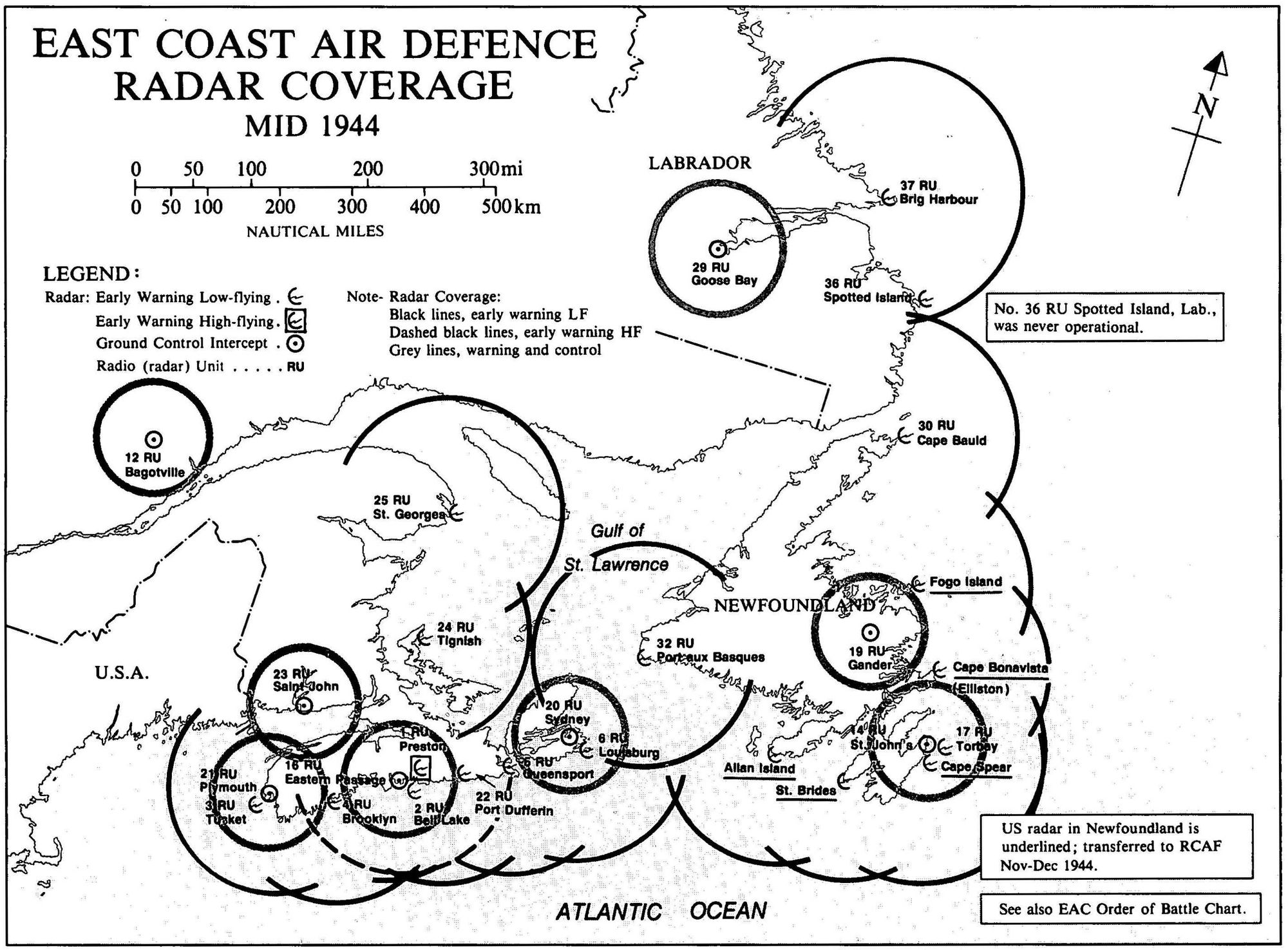
Construction of a chain of radar stations for surveillance of the Pacific Coast began in 1942 and was completed by November 1943. These stations, initially called "Radio Detachments" and later "Radio Units," were part of the Pacific Coast Air Defence Radar System and operated until the end of the war in 1945. The RCAF also had an Atlantic Region Air Defence system in place during World War II.