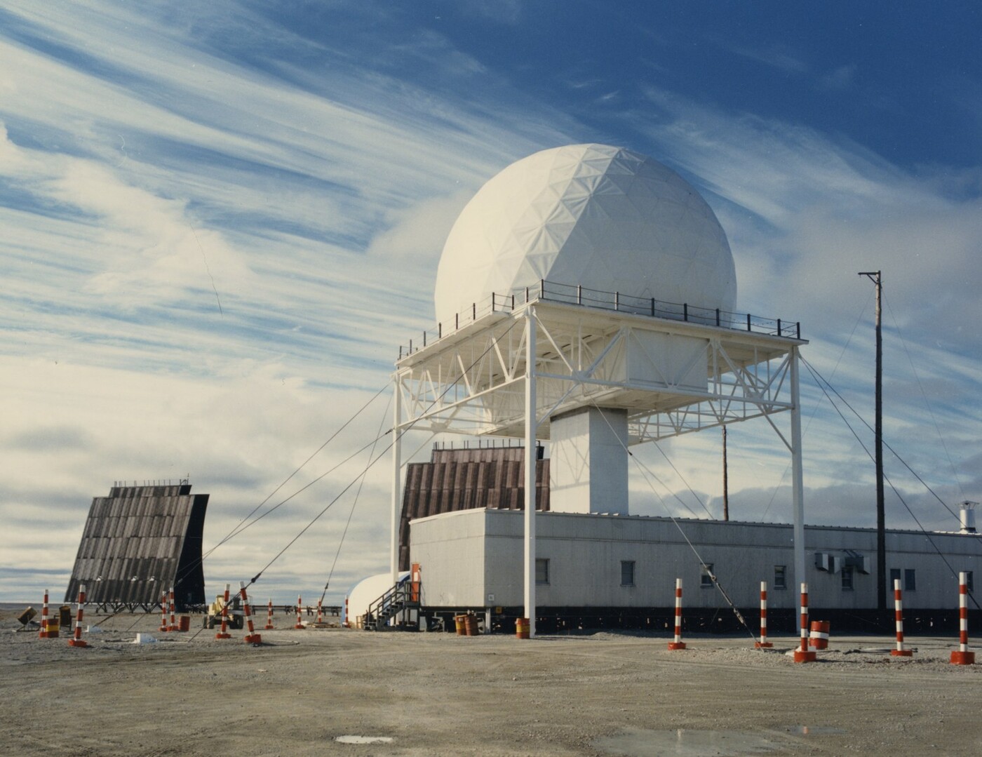
A watchful eye on the north.
I first heard of the DEW Line many years ago by accident when learning about high-arctic communities, their struggles, and the native people who live in some of the harshest conditions I can imagine. While reading about those communities, I learned that some were connected to military bases that operated during the Cold War (and some of which continue today through successor programs). I opened Google Earth and found dozens of sites, many still with buildings or foundations visible, and a patchwork of roads and airstrips all across the north edge of Canada. It was then my interest in the story of these incredible radars began.
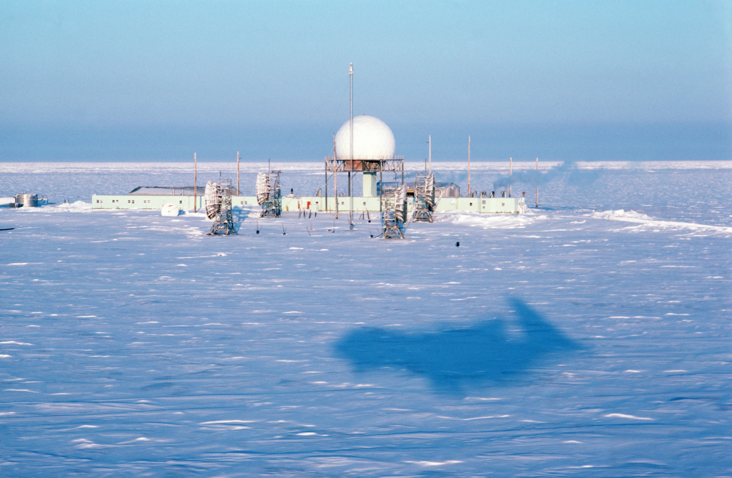
The Distant Early Warning Line was a chain of radar stations strung across the top of North America in the 1950s; it covered from Alaska's northwest coast, across Canada's Arctic, and later over Greenland to Iceland. Originally the line was built to give a few hours' warning of a Soviet bomber attack coming over the pole.1
It was conceived in 1952 and built between 1954 and 1957 in some of the harshest conditions on Earth, keeping a 24/7 radar watch for 36 years before handing over to its successor in 1993. The official count was 57 stations in the line proper: 6 main, 23 auxiliary, and 28 unmanned intermediate sites. Sites were spaced at roughly 100-mile intervals near the 69th parallel, with later extensions adding four stations in Greenland and six in the Aleutians.2
Origins
After the Soviet Union's first atomic bomb test in 1949, U.S. and Canadian defense planners had a new nightmare: nuclear-armed long-range bombers coming over the polar region, the shortest route between the two countries.3
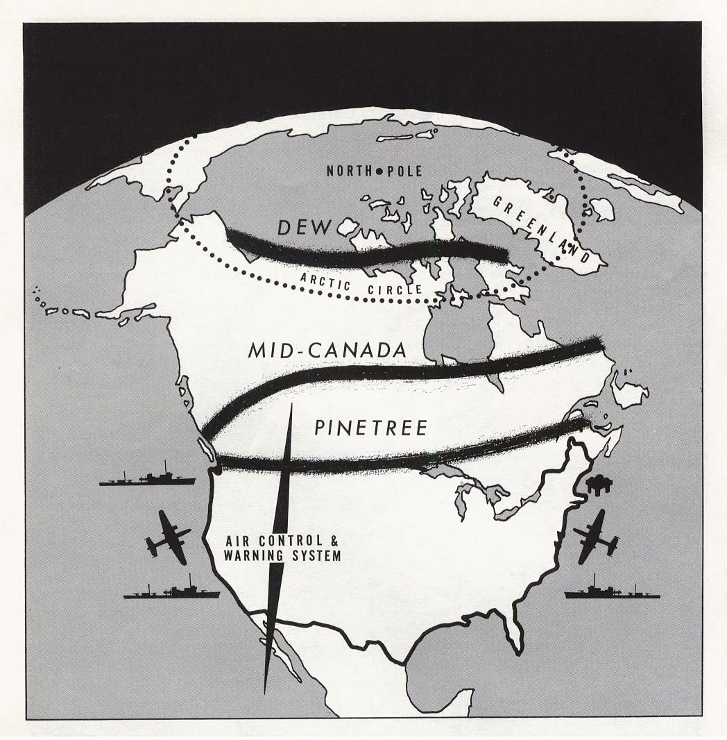
The radar coverage that existed couldn't provide adequate protection against this new threat. The Mid-Canada Line at roughly 55°N was a Doppler fence that could tell you something crossed it, but not what or where it was headed; the Pinetree Line hugged the Canada-U.S. border, far too close to the targets. By the time either line saw a bomber, the warning was measured in minutes.
In the summer of 1952, an MIT Lincoln Laboratory study group examined the problem and recommended building a “distant” early warning line across the Arctic as rapidly as possible.4 By December 1952, Lincoln Lab was under contract to deliver ten radar sets by the end of April 1953, for shipment north that summer. The first experimental station went up at Barter Island, Alaska, where Lincoln Lab and Western Electric engineers tested radars and communications through 1953–54 under harsh Arctic conditions (a second test bed ran at Streator, Illinois).5
The trials proved two things that made the whole line workable: an automatic signal alarm, so a handful of operators didn't have to stare at scopes around the clock, and reliable tropospheric scatter radio links that could push data over the horizon between stations.6
Construction
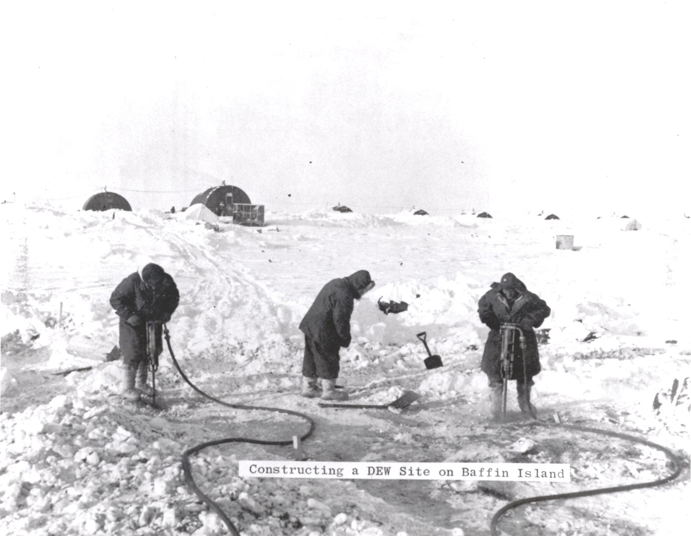
The U.S. Department of Defense handed the job to Western Electric (the manufacturing arm of the Bell System) as prime contractor in December 1954. From that standing start, some 25,000 people were directly engaged in planning and building the line, and about 460,000 tons of material moved north by ship, aircraft, barge, and tractor train.7
Everything about the logistics needed improvisation at scale. Staging areas went up at Point Barrow and in the Canadian Arctic. Sealifts ran during the brief summer thaw; “cat trains” of tractors hauled prefabricated modules over frozen tundra in winter; survey crews sometimes parachuted bulldozers onto frozen lakes to scrape out airstrips for C-124 transports.8
The basic building unit was a prefabricated module 28 feet long, 16 feet wide, and 10 feet high, bolted together into long “trains.” A main station was two parallel trains of about 25 modules each, joined by a central corridor into an H so nobody had to step outside in a whiteout to get from the mess hall to the radar room.9
The official history puts construction costs at about $350 million in 1950s dollars across 113,000 purchase orders, $200 million of it deliberately spent with Canadian firms. You'll see figures up to $750 million quoted for the total including equipment and transport, but even the DEW Line's own historians label those unconfirmed.10
Two years and eight months after the initial Western Electric contract's signing, the line was delivered and accepted as complete on July 31st, 1957.11

How it worked
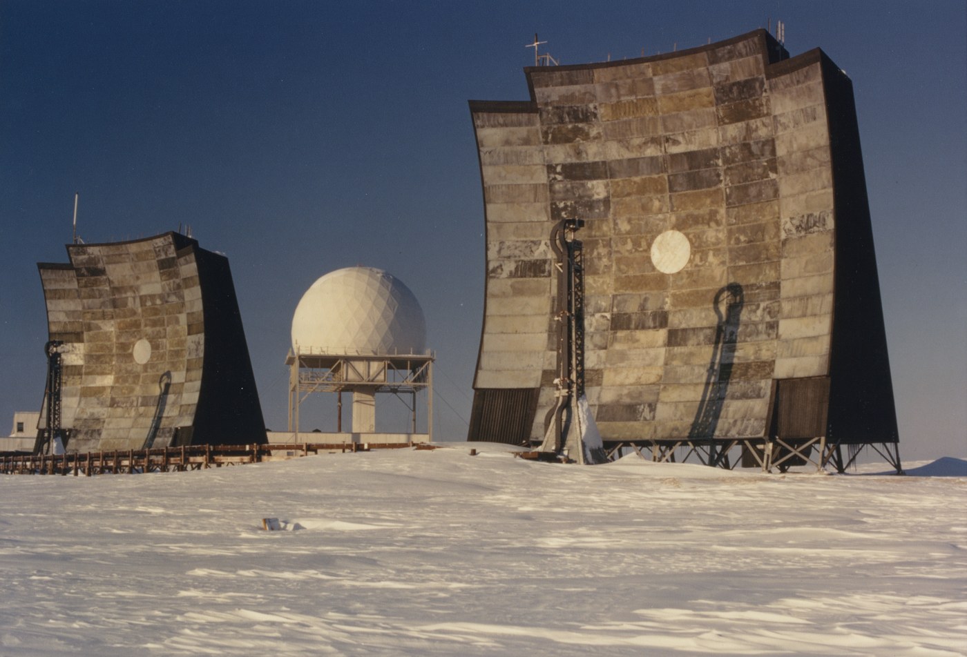
Every staffed station did two jobs: watch the sky and pass the word. The heart of each main and auxiliary station was the AN/FPS-19, an L-band search radar developed by Lincoln Laboratory. Two antennas sat back-to-back under the radome, one beam tilted low and one high, sweeping together so that neither a deck-hugging bomber nor a high-altitude one could pass unseen.12
Between stations, the line ran an invisible tripwire: the AN/FPS-23 “Fluttar,” a continuous-wave Doppler fence transmitted from unmanned intermediate sites and received at the manned stations on either side. Anything crossing the beam (down to about 50 feet over water, 200 feet over land) rang the alarm. Both radar types were gated to ignore targets under 125 mph so migrating birds wouldn't light up the line.13
The entire system was tuned to a design false-alarm rate of one per station per day. This was a remarkable target for 1950s electronics, making millions of automated detection decisions every 24 hours.14
Getting the warning south was the other half of the engineering. Satellites didn't exist and Arctic conditions made HF radio unreliable, so the line leaned on tropospheric scatter: AN/FRC-45 equipment in the 755–985 MHz band bounced a sliver of a powerful microwave signal off the upper troposphere to reach beyond the horizon.15 In Alaska this tied into the White Alice network; 30-foot dishes pushing 1 kW on short hops, up to 120-foot billboard antennas at 50 kW on the long ones.16 “DEW Drop” (a name often applied to the entire network) was specifically the troposcatter link from Cape Dyer to Thule, and Thule onward to FOX.17
All of it ran on diesel. Each station kept multiple generators running around the clock, fed from fuel farms whose huge cylindrical tanks became a signature silhouette of every site. Decades later, this thirst for diesel would lead to immense environmental cleanup of the sensitive Arctic tundra.
Life on the Line
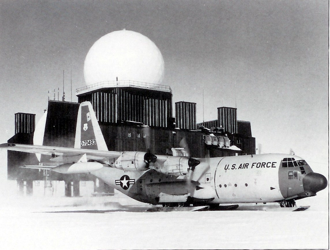
From the day it went operational, the DEW Line was mostly a civilian operation. The USAF contracted operations and maintenance to Federal Electric Corporation (ITT's service arm, formed in 1945), which beat 18 other bidders for the job. FEC's first cadre arrived on the line in October 1956, and the formal turnover ceremony was held at POW-Main in August 1957.18
The stations were leaner than I'd originally expected, given the scale of the maintenance and operational requirements. The 1957 authorization put 45 to 50 civilians plus a small military staff at each Main station, 16 to 18 at an Auxiliary, and nobody at all at the Intermediate sites, which were visited only for maintenance. Main station headcounts grew over the years, with veterans recalling 225 to 250 at the big sites in later eras.19 Civilians typically signed 18-month contracts at around $1,000 a month plus completion bonus ($11,926 monthly in 2026 dollars) with two weeks' leave at the halfway mark.20
Radician Paul Kelley left the best guided tour of a station's insides: the module train at FOX Main housing the ionospheric scatter terminal, the communications center, transmitter and receiver rooms, the surveillance room with its plotting boards, and the FPS-19 room under the radome with one transmitter/receiver set per beam. In the darkened surveillance room, the sweep of the scope was the only light; behind a light-proof curtain, a military controller stood ready to act on whatever the radician found.21
The isolation was the real enemy. Rick Ranson, who worked the line as a welder, put it like this: “Like ancient guards in a lonely outpost on the Great Wall of China or Hadrian's Wall, we watched, we waited, and we slowly went nuts.”22 Off-shift life was mess-hall movies, card games, ham radio, and (at stations that didn't crack down on it) an improvised bar. Some quit after one tour; others fell for the Arctic and stayed for years.
The line produced its share of only-in-the-Arctic stories. In the fall of 1956, a C-124 Globemaster mistook the beacon at POW-1 for POW-Main and put down on the auxiliary's 3,000-foot strip, which was far too short to take off from again. The crew got it stopped undamaged, and the aircraft sat there until about February 1957, when an ice runway roughly twice as long could be built to let it fly out.23
The people who were already there
The Arctic the DEW Line was built across wasn't empty. For Inuit communities, the line brought wage labor, airstrips, and permanent settlements, and upheaval that outlasted the radars. Hall Beach (Sanirajak) exists as a community because of FOX Main; elders there still describe the barrel-hauling and fuel work the station ran on.24
Inuit men worked construction and station support across the line, and the Listening to Our Past oral history project collected their own accounts of that work.25 The Qikiqtani Truth Commission's broader reports document the other side of the ledger: sedentarization pressure, disrupted travel and harvesting patterns, and decisions made about the North with nobody from the North represented while their future was decided.26
After much too long, that history has finally begun to be told. In 2023, the Diefenbunker museum opened “An Inuit Story: The DEW Line,” its first permanent gallery on the Inuit experience of the line, and in 2024 its team traveled to FOX Main at Sanirajak to document the site with the community.27
What it changed
But with all that investment, environmental damage, and human effort, we have to ask a basic question: did it work? It did close the door it was meant to close, and importantly convinced the Soviets that the door was closed. Before the DEW Line, a polar bomber raid could have arrived essentially unannounced; after mid-1957, any large formation coming over the pole would be seen hours out: enough time to scramble interceptors and get retaliatory forces off the ground. A once-Top Secret Institute for Defense Analyses study of U.S. warning systems is candid about both the value and the limits of what those hours bought.28
There were many limits, most of them downplayed or unspoken in public but discussed frankly in internal documents. NORAD's Sky Shield exercises of 1960–62 flew SAC bombers (and RAF Vulcans playing Soviets) against the continent's defenses; the results stayed classified until 1997, and they showed roughly half of low-level penetrators getting through.29
Politically, the line rewired the continent. NORAD stood up in 1958, the year after the line went operational, to unify what the DEW Line and the other radar lines were feeding. And because most of the stations stood on Canadian soil, the 1955 Canada–U.S. agreement that authorized them came loaded with sovereignty conditions (Canadian staffing, Canadian firms, Canadian law) that shaped Arctic policy for decades.30
By the early 1960s the main threat had shifted to ICBMs, which the DEW Line's radars weren't designed to see; that job went to the new BMEWS sites at Thule, Clear, and Fylingdales. One popular story needs untangling: the October 5th, 1960 false alarm, when a rising moon was read as a massive missile raid, happened at Thule's BMEWS radar, not on the DEW Line.31 Soviet long-range aviation probed the line's edges for the rest of the Cold War (much as Russian aircraft continue to do today), and the DEW Line kept watching them.
What's left
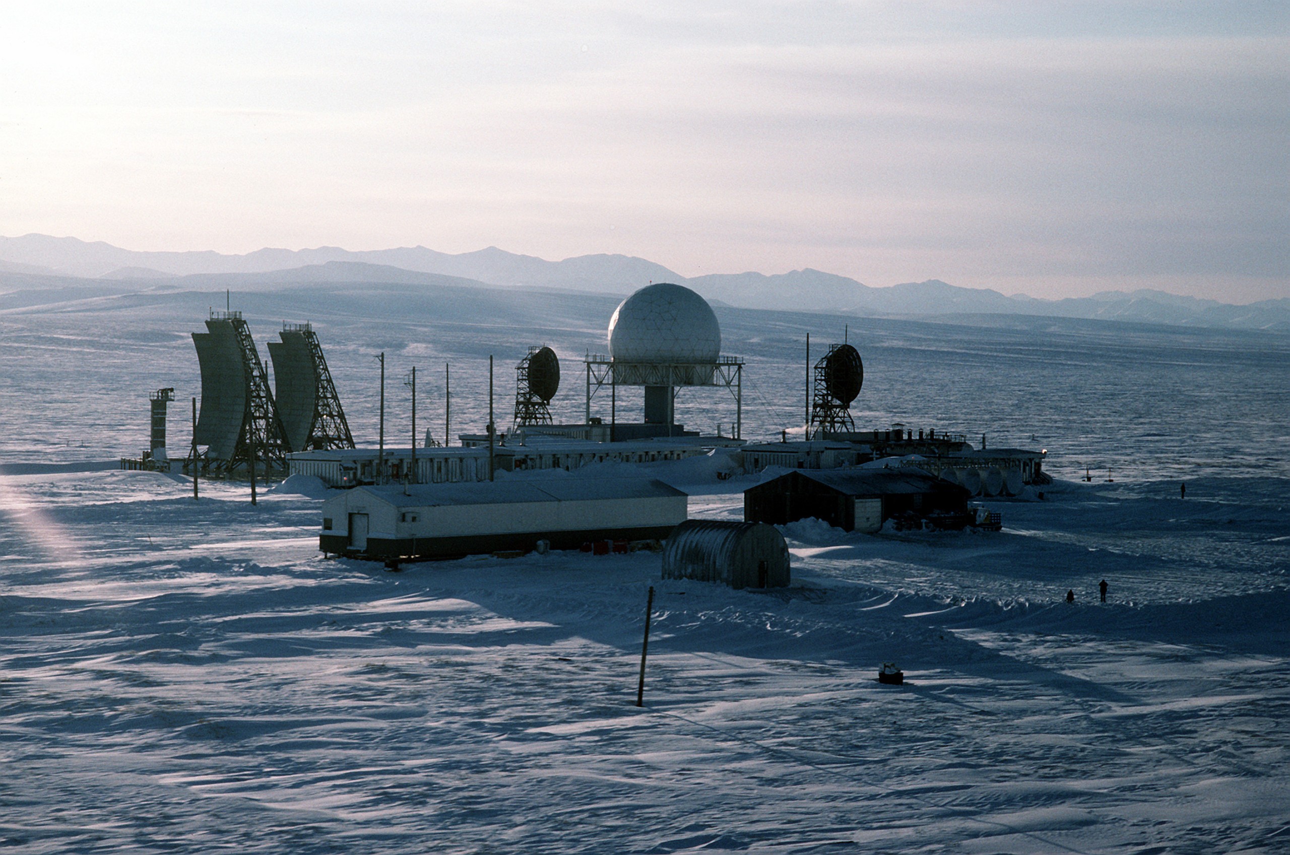
At the 1985 “Shamrock Summit,” the U.S. and Canada agreed to replace the aging line with the North Warning System: unmanned, solid-state AN/FPS-117 long-range radars backed by AN/FPS-124 gap-fillers. The transition ran from 1988, and the formal handover from DEW Line to NWS came on July 15th, 1993.32 About half the old locations lived on under the NWS; the rest were abandoned where they stood.
What they left behind were PCBs, fuel, lead, and debris across 21 Canadian sites. The stations remained abandoned in place and untouched for much longer than would be typical of such installations, and the eventual remediation took longer than the line took to build and operate. The Department of National Defence's clean-up ran from 1989 to 2014, shipped some 35,000 cubic metres of contaminated material south, and cost $575 million: the largest environmental remediation project in Government of Canada history.33
On the Greenland ice cap, DYE-2 and DYE-3 were simply walked away from in 1988–89 and are slowly being swallowed by the ice sheet they were jacked above for thirty years.34 A photographer's collection of c. 1960 DEW Line images, donated to the Canadian Centre for Architecture in 2016, pairs hauntingly with what the sites look like now.35
I'm documenting the stations themselves as separate pages on this site. The six Main stations POW, BAR, PIN, CAM, FOX, and DYE, plus DYE-1 in Greenland are there now, with more of the DYE ice-cap stations on the way when I have the time to properly document them individually.
Resources
There are many, many amazing folks who have written about the DEW Line, collected resources, and shared their stories. Here's everything I've found and used; where I've referenced a source directly, it's also linked as a footnote in the text above.
Primary documents and technical histories
- Thomas W. Ray, A History of the DEW Line, 1946–1964 (ADC Historical Study No. 31, declassified)
- Naka & Ward, “Distant Early Warning Line Radars,” Lincoln Laboratory Journal 12:2 (2000)
- Western Electric, The DEW Line Story (1958)
- Wainstein et al., Evolution of U.S. Strategic Command and Control and Warning (IDA 1975, declassified excerpts)
- The DEW Line Coordinating Committee Minutes and Progress Reports (DCASS vol. 15)
- Winkler, Searching the Skies (1997), in our archive
First-hand accounts
- Paul Kelley, The DEWline – A Brief Introduction and “Memories of FOX Main”
- Lynden T. (Bucky) Harris, The DEWLine Chronicles
- Rick Ranson, Working North: DEW Line to Drill Ship (NeWest Press, 2003)
- Frances Jewel Dickson, The DEW Line Years: Voices from the Coldest Cold War (Pottersfield Press, 2007)
- Gareth Howard, Dew Line Doctor (1960)
- Richard Morenus, Dew Line (Rand McNally, 1957)
- CBC Radio, “Lives on the DEW Line” (1959)
Inuit voices
- Qikiqtani Truth Commission, Thematic Reports and Special Studies 1950–1975
- QTC Community Histories: Hall Beach (Sanirajak)
- “Work at the DEW Line Sites: Some Memories,” Listening to Our Past (archived)
- Stacey A. Fritz, DEW Line Passage: Tracing the Legacies of Arctic Militarization (PhD diss., UAF)
- Diefenbunker, “An Inuit Story: The DEW Line” gallery and FOX Main documentation project
Films and photographs
- Bell System DEW Line film, in our archive
- Arctic Mission (Western Electric, 1955)
- The Big Picture: DEW Line (US Army, c. 1957–58)
- Land of White Alice (Western Electric, c. 1959)
- Radar Station (NFB, 1953)
- “Everyone Just Left”: CCA DEW Line photo collection essay
- US National Archives digitized DEW Line holdings
Scholarship
- S.E. Twitchell, The Incomplete Shield (MA thesis, Iowa State, 2011)
- J.L. Isemann, To Detect, to Deter, to Defend (PhD diss., Kansas State, 2009)
- Lackenbauer, Farish & Arthur-Lackenbauer, The DEW Line: A Bibliography and Documentary Resource List (AINA, 2005)
- Farish & Lackenbauer, “The Cold War on Canadian Soil,” Environmental History 12:4 (2007)
- Myra Hird, “The DEW Line and Canada's Arctic Waste,” The Northern Review 42 (2016)
- Peter Grier, “A Line in the Ice,” Air Force Magazine (Feb 2004)
Websites
- DEWLine Adventures, Larry Wilson's site, maintained by Brian Jeffrey
- The DEWLine Virtual Museum
Sources & Resources
Government Reports
- Searching the Skies: The Legacy of the United States Cold War Defense Radar Program Survey of the US Cold War radar program with DEW Line coverage
- NORAD historical image library (USNORTHCOM FOIA release 26-R-025) Period DEW-Line photographs (Baffin construction, C-130 resupply, billboard antennas) and the 1960 three-lines schematic on this page - USNORTHCOM FOIA 26-R-025
Film & Video
- Bell System Distant Early Warning Nuclear Attack Warning System Film Period Bell System film on the DEW Line warning system
- “DEWLine History”, on Larry Wilson’s DEWLine Adventures site, an incredible resource for DEW Line information and history. Wilson died in 2020; Brian Jeffrey maintains the site today. ↩
- Thomas W. Ray, A History of the DEW Line, 1946–1964, ADC Historical Study No. 31 (1965, declassified), the declassified official USAF history. Popular accounts often say “63 stations,” counting rearward communication sites and extensions differently. ↩
- Paul Kelley, The DEWline – A Brief Introduction is a first-hand account by a DEWLiner (1960–62) and an excellent short overview of why the line was built. ↩
- Thomas W. Ray, A History of the DEW Line, 1946–1964, ADC Historical Study No. 31 (1965, declassified). ↩
- F.R. Naka and W.W. Ward, “Distant Early Warning Line Radars: The Quest for Automatic Signal Detection,” Lincoln Laboratory Journal 12, no. 2 (2000); Thomas W. Ray, A History of the DEW Line, 1946–1964, ADC Historical Study No. 31 (1965, declassified). ↩
- F.R. Naka and W.W. Ward, “Distant Early Warning Line Radars: The Quest for Automatic Signal Detection,” Lincoln Laboratory Journal 12, no. 2 (2000) which is the definitive, although congratulatory because of their direct involvement, engineering account of how they solved the automatic-detection problem. ↩
- “DEWLine History”; corroborated in Peter Grier, “A Line in the Ice,” Air Force Magazine, February 2004. ↩
- Western Electric’s own 1958 account, The DEW Line Story, and the 1955 construction film Arctic Mission show more on this phase. ↩
- “DEWLine History”; Thomas W. Ray, A History of the DEW Line, 1946–1964, ADC Historical Study No. 31 (1965, declassified) describes the module-train configuration. ↩
- Thomas W. Ray, A History of the DEW Line, 1946–1964, ADC Historical Study No. 31 (1965, declassified), p. 31. The $750M figure appears on “DEWLine History” explicitly flagged as “unconfirmed rumors.” ↩
- Thomas W. Ray, A History of the DEW Line, 1946–1964, ADC Historical Study No. 31 (1965, declassified); “DEWLine History”. ↩
- F.R. Naka and W.W. Ward, “Distant Early Warning Line Radars: The Quest for Automatic Signal Detection,” Lincoln Laboratory Journal 12, no. 2 (2000), Table 1: 1220–1350 MHz, 160 kW peak power, 6 µs pulses at 400 per second, instrumented to 160 nautical miles are the Lincoln Lab design characteristics; production FPS-19 figures vary by source. Practical detection over poor terrain was closer to 70 nautical miles. ↩
- Thomas W. Ray, A History of the DEW Line, 1946–1964, ADC Historical Study No. 31 (1965, declassified) (the 125 mph speed gate); F.R. Naka and W.W. Ward, “Distant Early Warning Line Radars: The Quest for Automatic Signal Detection,” Lincoln Laboratory Journal 12, no. 2 (2000) on the Fluttar design and bird rejection. ↩
- F.R. Naka and W.W. Ward, “Distant Early Warning Line Radars: The Quest for Automatic Signal Detection,” Lincoln Laboratory Journal 12, no. 2 (2000), pp. 188–189. ↩
- Thomas W. Ray, A History of the DEW Line, 1946–1964, ADC Historical Study No. 31 (1965, declassified). ↩
- White Alice Communications System; see also the period Western Electric film Land of White Alice. ↩
- “DEWLine Communications Systems,” DEWLine Adventures. ↩
- “FEC History,” DEWLine Adventures; Thomas W. Ray, A History of the DEW Line, 1946–1964, ADC Historical Study No. 31 (1965, declassified). ↩
- Thomas W. Ray, A History of the DEW Line, 1946–1964, ADC Historical Study No. 31 (1965, declassified) (initial authorizations); “DEWLine History” (later staffing). ↩
- “The DEW Line,” Invention & Technology. ↩
- Paul Kelley, “Memories of FOX Main,” DEWLine Adventures; see also Paul Kelley, The DEWline – A Brief Introduction. ↩
- Rick Ranson, Working North: DEW Line to Drill Ship (NeWest Press, 2003), quoted in Peter Grier, “A Line in the Ice,” Air Force Magazine, February 2004. ↩
- The account appears in “DEWLine History”, a single veteran-memoir source, so treat the details accordingly. ↩
- Qikiqtani Truth Commission, Community Histories: Hall Beach (Sanirajak) (2013). ↩
- “Work at the DEW Line Sites: Some Memories,” Listening to Our Past, Nunavut Arctic College (archived). ↩
- Qikiqtani Truth Commission, Thematic Reports and Special Studies 1950–1975 (2013). ↩
- Diefenbunker, “Documenting the DEW Line” (2024); Nunatsiaq News coverage of the exhibit. ↩
- L. Wainstein et al., The Evolution of U.S. Strategic Command and Control and Warning, 1945–1972 (IDA, 1975, declassified), DEW Line and BMEWS excerpts. ↩
- “This Is Only a Test,” Air & Space/Smithsonian. ↩
- The 1955 Exchange of Notes is reproduced in P.W. Lackenbauer, M. Farish and J. Arthur-Lackenbauer, The DEW Line: A Bibliography and Documentary Resource List (Arctic Institute of North America, 2005) ↩
- David Wright, “The Moon and Nuclear War,” Union of Concerned Scientists. ↩
- Distant Early Warning Line, Wikipedia; the handover date is confirmed in Alexander Michael Daniel, âNo Modernization on their Radar: The Long Road to DEW Line Replacement,â Journal of Military and Strategic Studies 23, no. 2 (2024), full text. ↩
- “DND announces DEW Line clean-up completed,” CBC News, March 2014; official DND release (archived). For the scholarly view of the waste legacy, see Myra Hird, “The DEW Line and Canada’s Arctic Waste,” The Northern Review 42 (2016). ↩
- Structural Analysis of DEW Line Station DYE-2, Greenland, 1983–1988 (CRREL, via DTIC). ↩
- Margo Pfeiff, “Everyone Just Left,” Canadian Centre for Architecture (2017). ↩