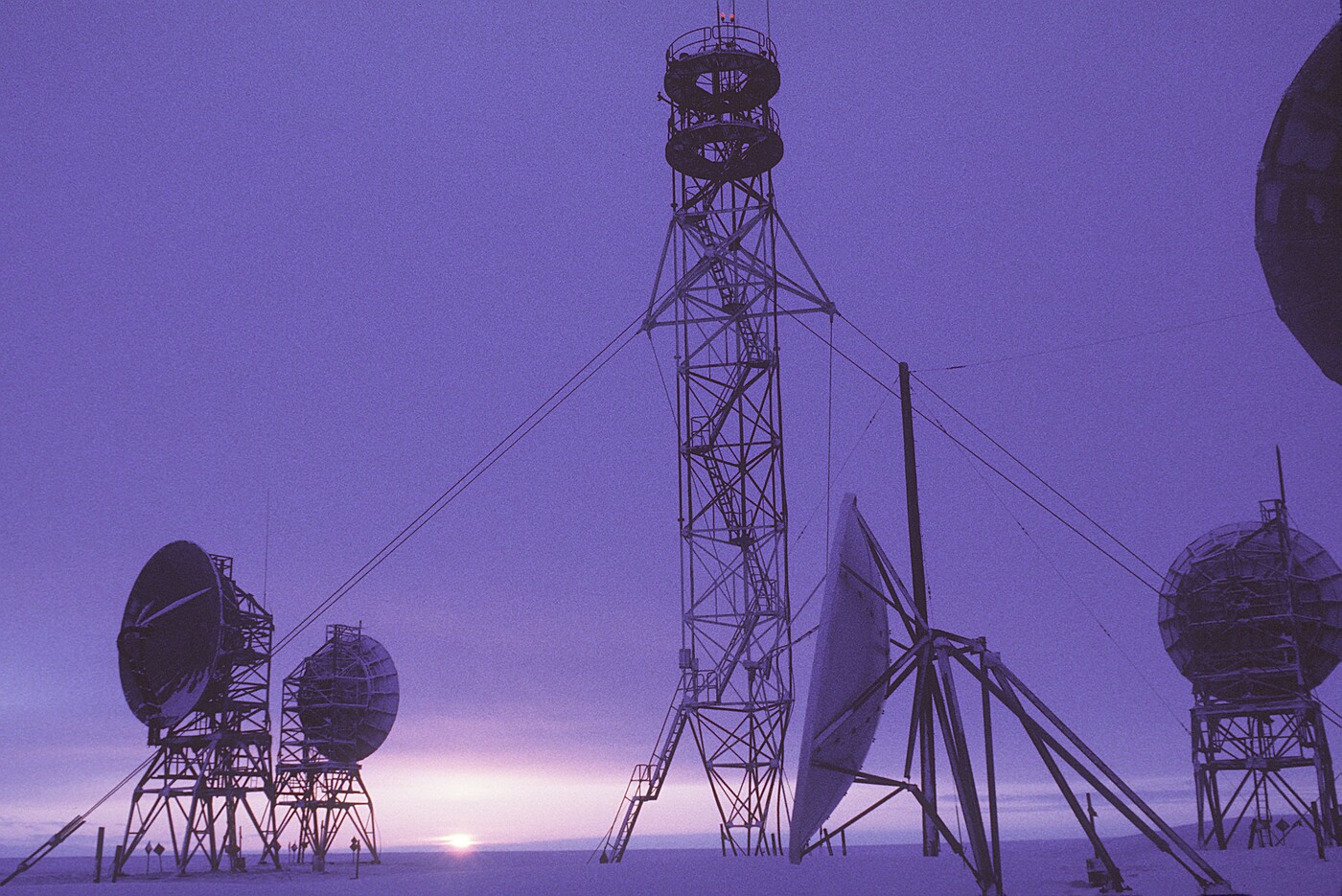
The sun sets behind the DEW Line radar station at Barter Island, Alaska, 20 February 1987 — the easternmost Main station in Alaska (BAR-MAIN). Parabolic tropospheric-scatter antennas on steel A-frame mounts stand in the foreground, carrying the long-haul “DEW Drop” communications links; a tall lattice antenna mast and a steerable parabolic dish rise at centre, with a geodesic radar radome at right. The original U.S. Air Force caption noted the station as “one of 30 under U.S. Air Force control on the Distant Early Warning (DEW) Line, which runs approximately 3,600 miles from Alaska, across Northern Canada, to Greenland.” (U.S. Air Force photo by TSgt Donald L. Wetterman.)
Coordinates: 70°08'02"N, 143°34'55"W
BAR-MAIN is the birthplace of the DEW Line. In February 1953, MIT Lincoln Laboratory and Western Electric personnel conducted proof-of-concept radar and communications tests here that demonstrated the feasibility of an Arctic early warning chain. The key breakthroughs — an automatic signal alarm that freed operators from constant scope-watching, and reliable tropospheric scatter radio links for over-the-horizon data transmission — directly led to the joint U.S.–Canadian authorization of full DEW Line construction in February 1954.
The station sits on approximately 4,500 acres of low-lying tundra at about 50 feet above sea level, 312 miles east of Point Barrow. It was the easternmost DEW Line site in Alaska, serving as BAR Sector headquarters and controlling nine subordinate stations — four auxiliary and five intermediate — spanning Alaska, the Yukon, and the Northwest Territories.
BAR Sector stations
During the DEW era, BAR-MAIN controlled the following stations:
- BAR-1 (Auxiliary) — Komakuk Beach, Yukon → NWS SRR, October 1990
- BAR-2 (Auxiliary) — Shingle Point, Yukon → NWS LRR, June 1989
- BAR-3 (Auxiliary) — Tuktoyaktuk, Northwest Territories → NWS SRR, September 1990
- BAR-4 (Auxiliary) — Nicholson Peninsula, Northwest Territories → NWS SRR, October 1990
- BAR-A (Intermediate) — Demarcation Bay, Alaska — closed 1963
- BAR-B (Intermediate) — Stokes Point, Yukon — closed 1963; re-established as NWS SRR, July 1991
- BAR-C (Intermediate) — Tununuk Camp, Northwest Territories — closed 1963
- BAR-D (Intermediate) — Atkinson Point, Northwest Territories — closed 1963
- BAR-E (Intermediate) — Horton River, Northwest Territories — closed 1963; re-established as NWS SRR, June 1991
Site layout
The airstrip runs along a narrow spit subject to erosion: 4,820 ft × 100 ft gravel (designated 07/25) at just 2 feet above sea level. The station featured the standard AN/FPS-19 L-band search radar housed in a geodesic radome, tropospheric scatter antennas for long-haul communications, and module-based construction typical of DEW Line sites. During the NWS transition, a prototype AN/FPS-124 Short Range Radar was constructed at the site.
Radar and communications
During the DEW era, BAR-MAIN used the AN/FPS-19 L-band search radar, operating in the 1220–1350 MHz band. Long-haul communications relied on tropospheric scatter antennas linking to adjacent stations across the Arctic — the same technology proven here in 1953. With the North Warning System transition, the site received an AN/FPS-117 solid-state 3-D radar, which remains operational today.
Operations
BAR-MAIN operated as one of six Main stations on the primary DEW Line, providing sector command and communications hub functions alongside POW-MAIN, PIN-MAIN, CAM-MAIN, FOX-MAIN, and DYE-MAIN. The successful proof-of-concept tests here in early 1953 led to construction of an 18-site test string across northeastern Alaska and northwestern Canada beginning in July 1953. The five intermediate gap-filler sites in the BAR Sector were closed in 1963 when the AN/FPS-23 Doppler detection concept was scaled back across the entire line.
Transition and current status
BAR-MAIN transitioned to the North Warning System in November 1990 with the installation of an AN/FPS-117 solid-state 3-D radar. The DEW Line was formally inactivated and the NWS officially activated on 15 July 1993. "Operation Clean Sweep," an environmental remediation effort initiated by PACAF in 1998, addressed legacy contamination at the site; cleanup was completed by 2005.
Airport
Barter Island LRRS Airport (IATA: BTI, ICAO: PABA) remains operational with a 4,820 × 100 ft gravel runway (designated 07/25) at 2 feet above sea level. The airport is owned by North Slope Borough and also serves the nearby community of Kaktovik. In the 12-month period ending December 2005, the airport recorded approximately 5,077 passenger boardings and 3,350 aircraft operations.