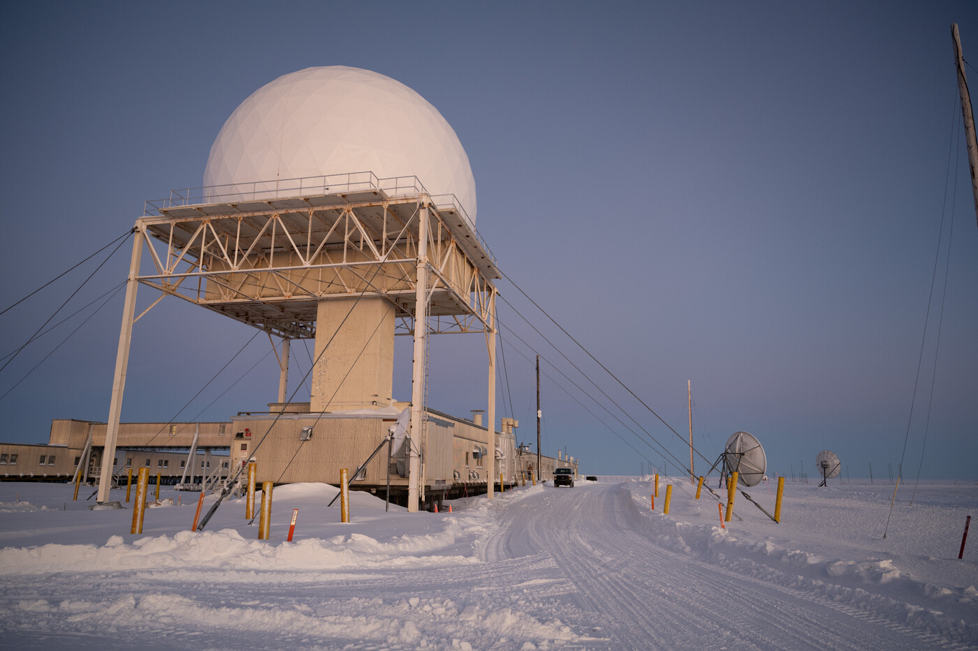
U.S. Air Force Long Range Radar site at Point Barrow Long Range Radar Site, Utqiagvik, Alaska, Feb. 10, 2025. Strategically placed radars around the state are managed by Pacific Air Forces Regional Support Center and play a crucial role in both national defense and weather monitoring. (U.S. Air Force photo by Senior Airman Quatasia Carter)
Coordinates: 71°19'38"N, 156°38'10"W
POW-MAIN was the westernmost Main station on the primary DEW Line, excluding the Aleutian COB sector extension added in 1959. Sited 5 miles southwest of Point Barrow — the northernmost point in Alaska — it served as sector headquarters for the POW Sector, controlling seven subordinate stations: three auxiliary (POW-1 at Oliktok Point, POW-2 at Lonely, POW-3 at Barter Island) and four intermediate gap-filler sites (POW-A through POW-D).
Site layout
The station occupied 268 acres of old, tundra-covered beach at approximately 10 feet above sea level, growing to over 600 acres at its maximum extent. Features included a 4,860-foot gravel runway (designated 04/24), the AN/FPS-19 L-band search radar housed in a geodesic radome, tropospheric scatter antennas for long-haul communications, dormitories, and extensive outdoor storage areas. The surrounding landscape includes a saltwater lagoon and a large freshwater lake; local natural gas deposits were tapped for heating and power generation.
Radar and communications
During the DEW era, POW-MAIN used the AN/FPS-19 L-band search radar, a long-range surveillance set operating in the 1220–1350 MHz band. Long-haul traffic flowed through tropospheric scatter antennas linking to adjacent Main and auxiliary stations across the Arctic. With the North Warning System transition, the site received an AN/FPS-117 solid-state 3-D radar, which remains operational today.
Operations
POW-MAIN operated as one of six Main stations on the primary DEW Line, providing sector command and communications hub functions alongside DYE-MAIN, FOX-MAIN, CAM-MAIN, PIN-MAIN, and BAR-MAIN. The four intermediate gap-filler sites in the POW Sector were closed in 1963 when the AN/FPS-23 Doppler detection concept was scaled back across the entire line. Auxiliary stations continued to operate.
Transition and current status
The station transitioned to the North Warning System beginning in the late 1980s, with the AN/FPS-117 radar upgrades operational by approximately 1990. The DEW Line was formally inactivated and the NWS officially activated on 15 July 1993. Today the site operates as NWS Long Range Radar Site A-17, staffed by civilian contractors on 18-month rotations under Alaska NORAD Region jurisdiction.
"Operation Clean Sweep," an environmental remediation effort initiated by PACAF, was completed in 2005 by the 611th Civil Engineering Squadron based at Elmendorf AFB (now Joint Base Elmendorf-Richardson). The airport remains operational for Air Force and contractor access.